Pariwar Fm
Type Locality and Naming
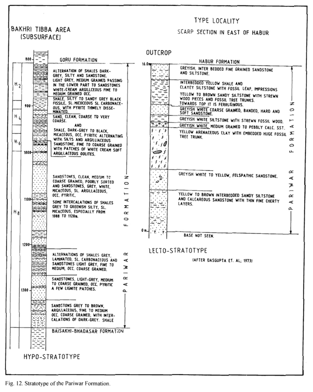
OUTCROP and SUBSURFACE. Scarp section East of Habur village. [Original Publication: Swaminath, J., Krishnamurthy, J.G., Verma, K.K., and Chandak, G.J., 1959, General geology of Jaisalmer area, Rajasthan, ECAFE Symposium, Mineral Research and Development Series 10: 154-155]. Reference well: Outcrops near Kuchri and Kali Dungri areas. Well Bhuana-1, interval 400-603m.
Synonyms: Oldham (1886) first described the formation as “Parihar beds”, which included the entire arenaceous sequence from Lower Cretaceous to Paleocene. Later on Swaminathan et al (1959) dropped the word “beds” and designated the sequence as Pariwar Formation. Dasgupta (1975) suggested informally two subdivisions in this formation Lower and Upper. The name was adopted by Narayan et al (1961) who equated it with Umia beds of Kutch. Willm (1964) spelled it as “Pariwar Formation”.
Lithology and Thickness
Siltstone. The lower part is represented by yellow to brown interbedded sandy siltstone and calcareous sandstone. The middle part consists of yellow sandy clay with embedded large fossil tree trunks. The upper part comprises of pebbly sandstone and siltstone with fossil wood at its base. Dasgupta (1975) has measured about 350 m thickness of the formation on surface. In subsurface maximum thickness of the order of 850 m is recorded in the well Lang-2.
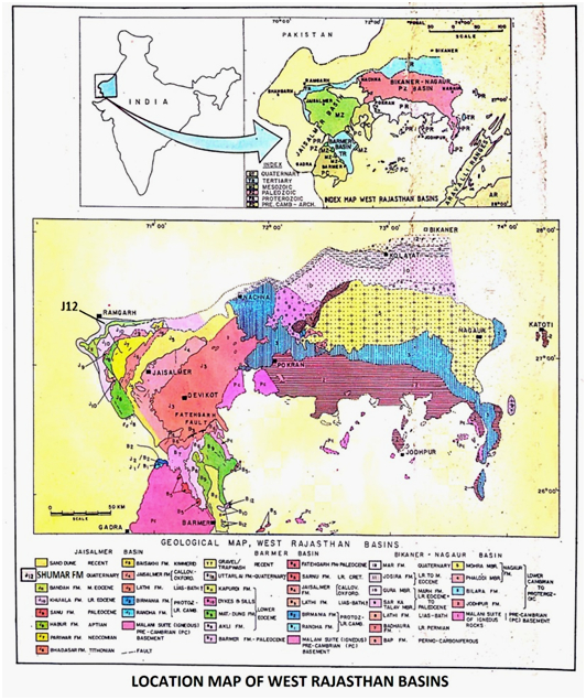
[Figure 1: Location map of West Rajasthan Basins (after Pandey and Dave, 1998)]
[Figure 2: Stratotype of Pariwar Formation, Mesozoic Lithostratigraphy of the Jaisalmer Basin, Rajasthan, Journal of the Paleontological Society of India, Vol. 51(2) (after Singh N.P, 2006)]
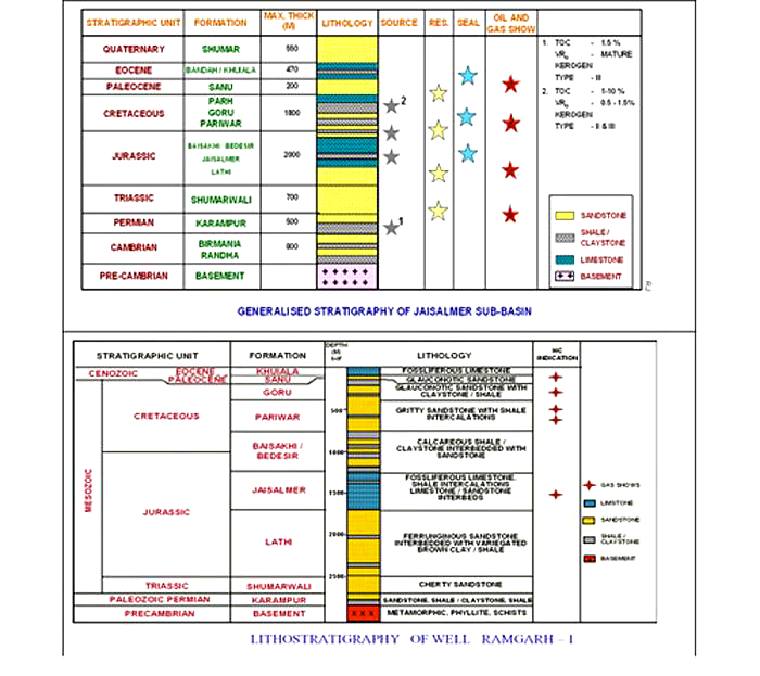
[Figure 3: Generalized and Subsurface Stratigraphy of Jaisalmer Basin (from dghindia.gov.in)]
Relationships and Distribution
Lower contact
In the outcrops the lower boundary has disconformable contact with the underlying Bhadasar Fm (ca. Tithonian), but in the subsurface the contact is conformable.
Upper contact
GeoJSON
Fossils
Epistomina cf. E. tenuicosta, Ammobaulites cf. minimus, Lenticulina cf. petecensis have been reported by Sigal and Singh (1980).
Age
Depositional setting
Continental with intermittent, shallow inner neritic
Additional Information


